I enjoy house sitting, Airbnb accommodation and Couch surfing for many reasons, one of the main reasons is the information a local person can give you.
A prime example of this was when I was deciding which way to come home after our recent farm sit.
“Have you heard of Putty Road?” Asked Kim.
The answer was “No”. So I Googled it.
The 174-kilometre (108 mi) Putty Road is very historic, closely following the Bulga Road (named after the Bulga Creek), first explored by John Howe, Chief Constable of Windsor, being the first road to link Sydney to the Hunter Valley. It was opened in 1823 and was initially a popular cattle-rustling route.[2]
Today, the road is fully sealed and from north to south, after leaving Singleton, passes through the settlements of Bulga, Colo, Milbrodale, and Putty. The Putty Road is bounded to the west and east by protectednational parks – the Wollemi National Park to the west, and the Yengo National Park to the east – both part of the UNESCOWorld Heritage–listed Greater Blue Mountains Area. The road is narrow and winding in places and very scenic. Wikipedia information
Now that sounds like my kind of journey.
The start of the Putty Road section was Windsor and it was market day. Windsor is the third-oldest place of British settlement on the Australian continent. Settlement at the location was first established about 1791.

It was a grey and drizzly sort of day and not many people around.
But this enterprising barber had customers waiting.

We had an interesting chat with this bloke as he sat making clay models using clay from his own property. Notice the 2 mailboxes next to him, the old and the new.


It is starting to rain again so time for a coffee before tackling Putty Road.

Putty Road rolls along with the bush of 2 National Parks on each side. Narrow and winding it follows the contours of the Blue Mountains. This is a motorbike enthusiasts dream road as it twists and turns sometimes almost turning full circle back on its self. At regular intervals hoardings warn motorcyclist of the danger of speed and inattention. I feel like a rally driver, but lament the fact that there is nowhere to pull over for photos. The scenery is stunning, occasional glimpses of a stream following the road then disappearing into the thick Aussie bush.

As we get to the other end of the road the bush gives way to fertile farm land. It was known as the “bread basket”, and in the early days of settlement it ensured the survival of the starving colony.

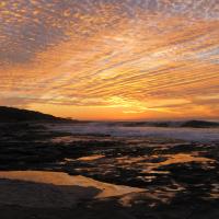
A steady rain is now falling, not really photography weather. The storm clouds are gathering.

As we neared the end of the Putty Road this poignant memorial tells of the dangers for truck drivers of this very tortuous road.


A final stop is made in the small township of Kurri Kurri
This was a major coal mining area, but now only one mine is still operating. The town’s economy today is largely based on the surrounding wineries now that the aluminium smelter closed in 2012.
The monument below was erected about the neighbouring town of Cessnock. I’m not sure why they put it in Kurri Kurri.


This pub is testament to the hey days of the mining, I can imagine all the miners making the pub their first port of call after knocking off work. Back then it was 6pm closing (known as “6 o’clock swill) and the blokes would swill down as much beer as they could before the call of “last drinks” rang out. Then stagger home with perhaps another dozen under their arm.
Today is Sunday and the town is deserted.

What really caught my eye and made me stop here was this giant kookaburra…


Nearing the end of our drive and the rain is now torrential and we learn later that the Putty Road had been closed just after we got through, due to slips and dangerous conditions.
I found this old 4 minute video on You Tube. A small part of history in the making…